
Copyright © Panorama Group 1991 - 2026

KB "Panorama" has developed the software complex version 15.5.0. The new version provides enhanced tools for working with geospatial data, improved analytics and advanced toolkit for land resource management. The update is focused on increasing the accuracy and efficiency of agronomic decision-making, which directly affects the increase in productivity and profitability of agricultural production.
The program has improved the task, which allows agronomists to work more conveniently with large information arrays. Advanced filters for rows by selected layer objects, color indication of changed data and support for tables with composite primary keys have been added. These improvements simplify the maintenance of electronic farm field books, processing of field monitoring data and report generation, reducing time costs for routine operations.
Significant attention has been paid to improving cartographic capabilities. The has added configuration of adjacency rules for linear objects, which ensures logical connection between map objects for forming networks of various purposes. This is especially important for creating accurate maps of agricultural enterprise infrastructure, reclamation systems and transport logistics.
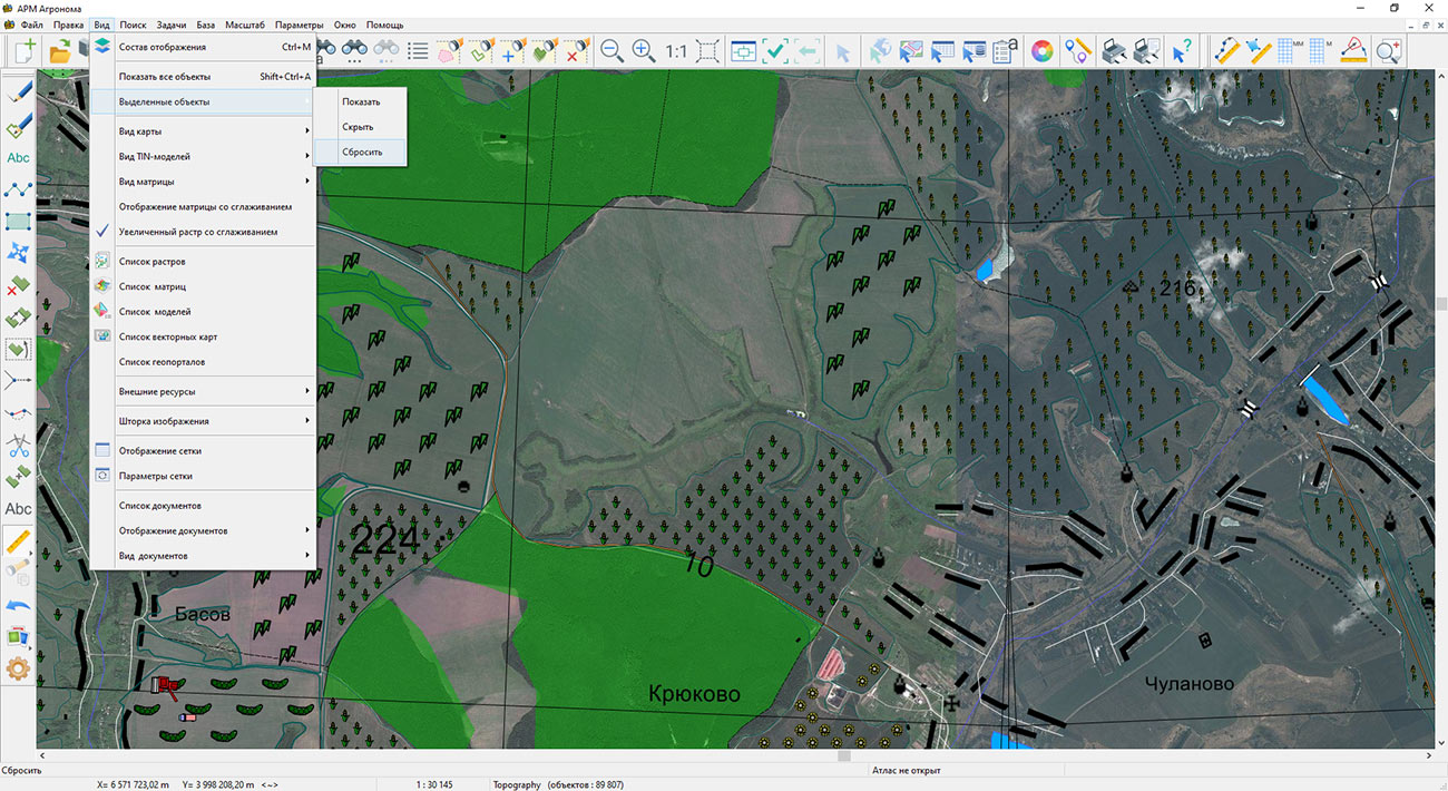
For agricultural producers working with large territories, an important improvement was the enhancement of the task with the ability to highlight all map objects and extended object search by "Inside and touching" criteria. This allows for more accurate analysis of the mutual location of agricultural lands, identification of unused plots and optimization of the enterprise's land bank.
The dialog has been improved, which speeds up the preparation of working lists of reference systems. This increases the accuracy of agronomic calculations and work planning. Support for the CGCS2000 Gauss-Kruger coordinate system has been added, which opens new opportunities for cooperation with Chinese partners and work in international markets.
New capabilities, including page number selection and copying objects between maps, simplify the preparation of reporting materials and data visualization for management decision-making. This is especially in demand when preparing crop rotation schemes, fertilizer application maps and planning agrotechnical measures.
For agricultural producers, the update means not only technical improvements, but also specific economic advantages. Increasing the accuracy of cartographic data allows optimizing the use of land resources, reducing costs for fuel and mineral fertilizers, and more accurately forecasting yields. Integration with state cadastral systems and geoportals ensures the relevance of information about land plots, which minimizes risks in land management and agricultural work planning.
The new version of the program is available in the section.



KB "Panorama" has developed the software complex version 15.4.2. The new version increases the efficiency of working with cartographic data and improves analytical tools. A number of innovations have been implemented that make the process of creating and editing maps more convenient and accurate.
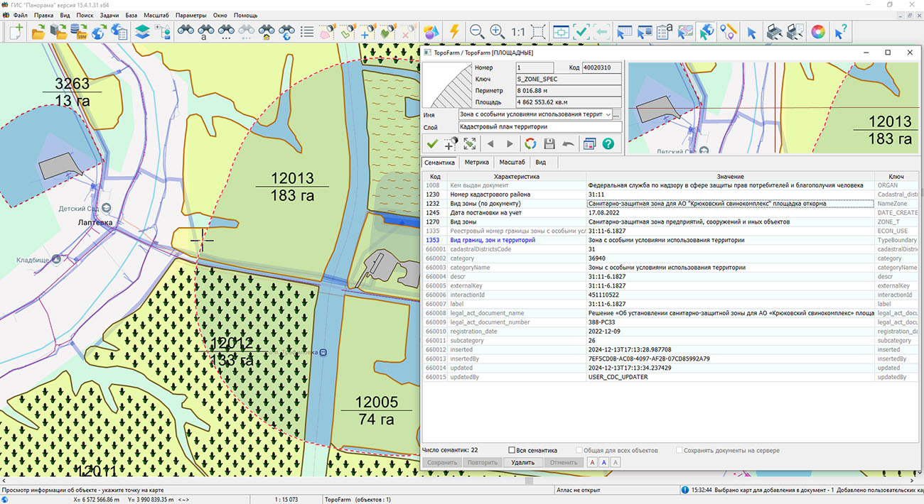
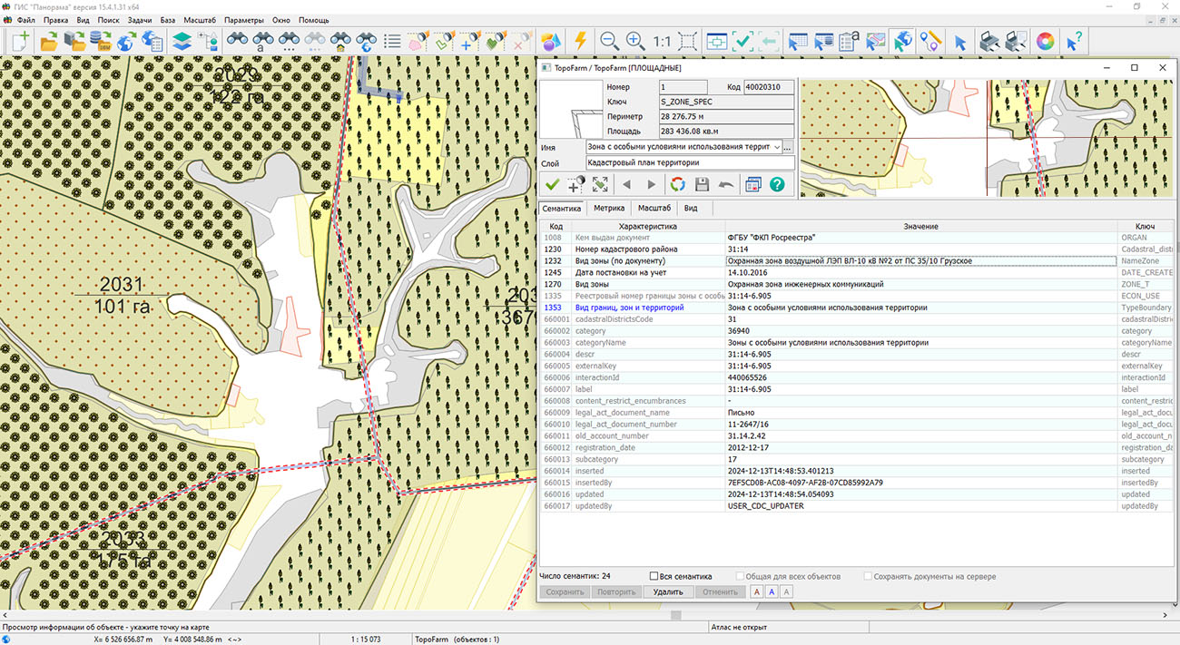
The program supports expanded access to information from the (NSDS) geoportal. Users can receive up-to-date data on the date when objects were registered, their cadastral numbers, status, land category, and the value of plots or buildings. For convenience, the layers "Land plots (labels)" and "Buildings (labels)" have been added, allowing users to quickly find necessary information directly on the map.
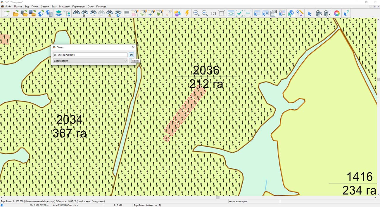
Special attention has been paid to improving search capabilities. A new search dialog has been developed that supports address search on OpenStreetMap, search by cadastral number, and cross-search in NSDS and other geoportals. Search results are displayed not only in tables but are also visualized on the map, which significantly simplifies working with large volumes of data.
For land management specialists, an expanded set of tools for processing object lists has been added, including operations for cutting and splitting complex objects from multiple cartographic sources. This is especially useful when creating detailed maps of farm infrastructure, land management, and agricultural lands.
Additionally, the algorithm for displaying labels on maps has been updated. Labels now take into account the rotation angle of the sign, ensuring more accurate and aesthetically pleasing placement of text information. For user convenience, the ability to copy point coordinates with a single click or key combination has also been added.
These changes make the "Agronomist Workstation" an even more flexible tool and help improve the quality of decisions made by specialists working in the field of land management and agronomy. The new version of the program is available in the section.

KB "Panorama" has developed version 3.2. In the new version, the construction of a hierarchical tree of field passports data and switching between elements in the list of arable land plots have been improved. The performance of displaying information has been enhanced when dealing with a large number of field passport records in the agricultural database. The functionality for working with cartographic projects of producers has been expanded in GIS WebServer AGRO, and their automation has been implemented in the administration module.
The management of field treatment accounting using plant protection products (PPP) has been optimized by utilizing information from a unified directory of pesticides and agrochemicals. A periodic check for connection to the remote data publication server has been added in case the remote server was unresponsive when opening a layer. This allows for connection restoration and retransmission of necessary requests. The data display speed during geospatial portal publication has been increased. Improved support for reading large maps (tens of gigabytes and above) on slow hard drives during simultaneous multi-user editing of these maps has been implemented.
GIS WebServer AGRO utilizes as a spatial data source. Synchronization of cartographic information described in the agricultural database and information published on GIS WebService SE is automatic. For collaborative data work, digital maps of agricultural lands and enterprise infrastructure are hosted on the . Its application enables synchronization between desktop "Panorama AGRO", web applications, and mobile clients. Desktop applications such as , "Workstation of agronomist", and others can connect to the GIS Server. This allows mobile clients working through the web to process the same data jointly with desktop clients.
To see an example of GIS WebServer AGRO in action, visit the demonstration project page. The new version of the program is available for on the website.


In the KB "Panorama", the software complex version 15.2 has been developed. In the new version, has been expanded. Additional layers from the Rosreestr geospatial portal are connected - Thematic Maps: Cadastre value of land plots, Land categories, Types of permitted land use, Lands for construction, Lands for tourism.
During land management, thematic maps allow for a quick visual assessment of a particular territory. For example, the map of cadastre value of land plots has 5 gradations: up to 3 million rubles, from 3 to 15 million rubles, from 15 to 30 million rubles, from 30 to 100 million rubles, and over 100 million rubles. Land category map - 8: not established, agricultural lands, forest fund, water fund, specially protected areas, settlement lands, industrial lands, reserved lands. The map of types of permitted land use contains over 220 gradations.
An important set of tools for a GIS specialist in creating infrastructure maps for agriculture is processing lists of objects. In the new version of the program, the corresponding dialog has been updated. The ability to cut and split objects belonging to complex lists containing objects from one or several maps opened in one window has been added.
To ensure consistency of symbol libraries on client machines, from the GIS Server has been added. Classifiers located on the server will be automatically updated on the client.
For more flexible data preparation for printing, in the dialog on the "Numbers" tab, the ability to set a unique object number that will temporarily not be visible on the map has been added.
The new version of the program is available for download in the section.


In KB "Panorama" the version 15.1.2 has been developed. In the new version, the "Satellite-based field recognition" mode has been updated, the dialog and the task have been improved. The integrated application of the "Workstation of agronomist" modes implements automated technology for maintaining a land bank and soil fertility base.
The updated mode ensures recognition of the boundaries of agricultural land contours based on Earth's remote sensing data. The program interacts with the Mapflow.ai service and, using a neural network, automatically deciphers and delineates the boundaries of working areas of arable land. The new version changes the user authorization protocol for the service, including the use of tokens issued in the user’s personal account. Information processing is performed in a local area limited by the polygon indicated on the map. The construction area can be specified by a rectangle or an arbitrary closed polygon. The construction of a vector model of working areas of arable land is carried out on the basis of automatically selected current remote sensing data of medium (10 m/px) and high resolution (1.2 m/px). In the new version a recognition of fields boundaries from Sentinel-2 images has been added. The vector data constructed by means of service is automatically loaded into the from GeoJSON format onto a map of the working areas of the agricultural enterprise. The field map is used to maintain field passports, construct thematic cartograms, obtain vegetation indices, maps of heterogeneity and nitrogen requirements, calculate the application of fertilizer doses and other agrotechnical calculations.
In the process of maintaining a land bank for an agricultural enterprise, the boundaries of field contours are often compared with the boundaries of cadastral objects. Determination of intersections and overlaps is performed using the mode. For clarity of the results of the analysis of the relative position of various groups of objects in the form of thematic layers, the "Lists of objects" dialog has been improved. Possibility of displaying list of objects by style (conventional symbol) customized by the user has been added. In the "Lists of objects" dialog, custom styles are automatically formed for the selected lists of objects. Custom styles for displaying lists of objects are a set of conventional symbols for polygons, lines and points. Style sets can be combined into themes. New features allow you to quickly add lists by selected objects on the map and perform tasks with lists: Building a zone around objects of the selected list, Cutting objects, Union of objects, Building the areas of objects crossing.
The application task "Map Legend" has been improved. Display of named lists of objects in the legend dialog has been added. Enabling and disabling the visibility of object lists is done by simply clicking the left mouse button on the icon corresponding to the list. On the map, lists of objects are displayed as separate thematic layers in accordance with user-customized legends. The composition and order of display of thematic layers in the general data list is controlled by enabling and disabling the visibility of the list of objects in the bottom panel. The convenience of designing the appearance of thematic layers has been improved: assigning a style and color to the list of objects has been added. Simple addition of selected objects into the list with automatic formation of names has been implemented.
The new version of the program can be downloaded on our website in the section.




 Mobile version
 Full version
