
Copyright © Panorama Group 1991 - 2026

KB "Panorama" has developed version 15.5.6 of the . This new version enhances tools used for maintaining digital agricultural land maps, processing remote sensing data, assessing terrain, and preparing reports on crop cultivation technologies.
In the task, functions for calculating the EVI, CVI, and GNDVI vegetation indices have been added. EVI is used for assessing dense vegetation and biomass; CVI for analyzing chlorophyll content and identifying early signs of plant stress; and GNDVI for evaluating photosynthetic activity and crop status during early growth stages. Calculations are performed using multispectral imagery data from satellites or UAVs, enabling the generation of crop condition maps, identification of zones with uneven plant development, and refinement of areas for field surveys.
To display the computed indices in the "Multispectral Image Analysis" task, users can apply predefined grayscale or color palettes, or load palettes from RSW or MTQ files. Display parameters set in the dialog are automatically applied to all open multispectral images. The vegetation index map can be saved as an MTQ quality matrix. Such matrices are used in preparing thematic crop cartograms and comparing survey results with field maps, crop rotation records, soil agrochemical data, and completed field operations.
In the task, when creating a new feature by entering coordinates from the keyboard, it is now also possible to load point coordinates for feature geometry nodes from SHP, OGC GML, and GeoJSON files. This allows the transfer of field boundaries, work plots, drainage elements, access roads, and other farm features from exchange materials without manual coordinate entry. Added modes include and . The first creates area and linear features based on the inner contours of one or more selected features; the second deletes sub-features of area features and additional contours of linear features within a user-specified area. These modes are useful for refining the structure of digital agricultural maps, separating internal contours, removing unnecessary sub-features, or preparing correct geometry for work plots for further recording and analysis.
Retrieval and display of terrain data requested via the OGC WCS standard from coverage services published via have been accelerated. OGC defines a "coverage" as a grid-based model of terrain, environmental quality, or a phenomenon varying in space or time. An optimal algorithm for using coverages for visualization and spatial analysis has been implemented. When viewing a map from the server, image tiles of the landscape corresponding to the current scale are requested with multi-level height generalization, resulting in faster terrain visualization. For analytical operations, such as terrain profile construction and slope calculation, queries for numerical height values are made from the highest-resolution coverage. For agricultural use, this data aids in slope analysis, assessing water runoff conditions, selecting tillage directions, and preparing reclamation materials.
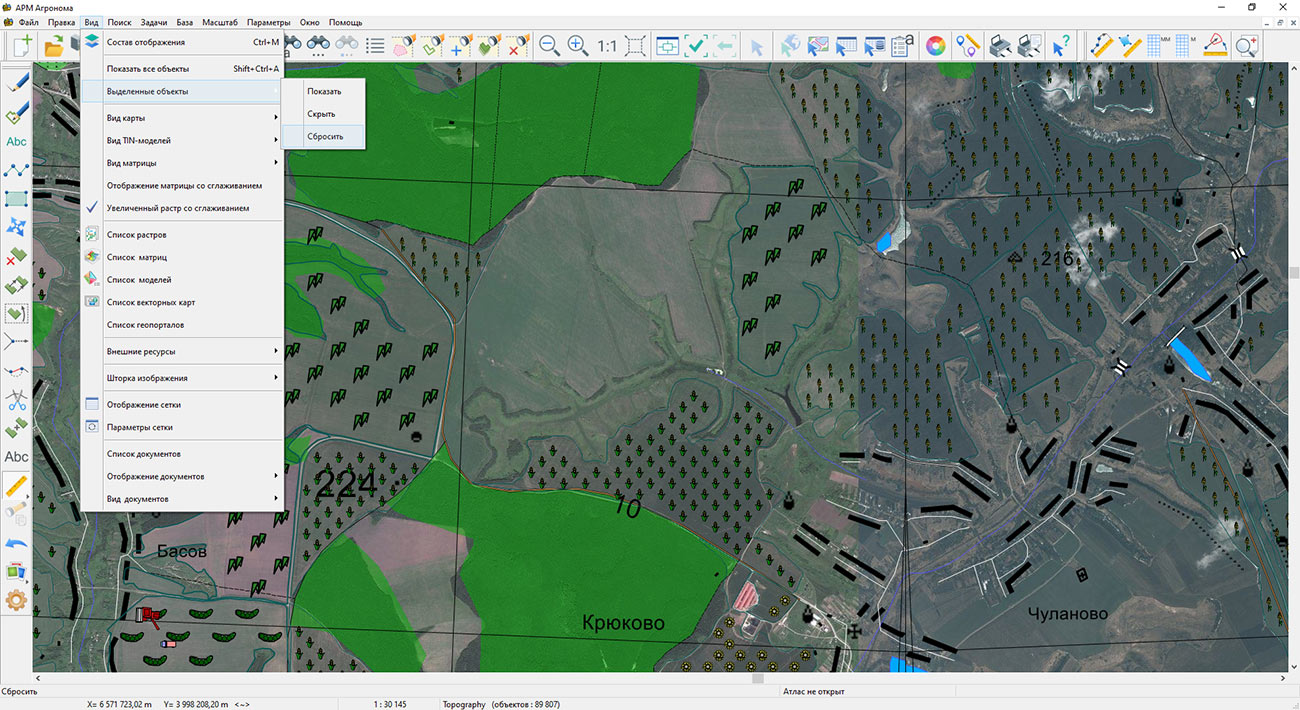
The full-screen map display mode, , has been enhanced. In this mode, users can add simple graphic objects to the map using a touch screen or mouse, rotate the map, and save screenshots to PNG, JPG, TIF, and BMP files. This mode can be called from the main menu "Window – Full Screen" and is useful for discussing field production situations, machinery routes, crop survey plans, and areas requiring crop condition clarification.
In the dialog, the ability to save feature attribute tables in HTML and DBF formats has been added. HTML is suitable for viewing tables in a web browser and preparing reports, while DBF allows further processing in information systems. Exporting attributes of field boundaries, work plots, and other map features in these formats simplifies data exchange between the agronomy service, farm management systems, and external contractors.
The new version is available for download in the section.


KB "Panorama" has developed version 15.5.3. The new version expands the tools for creating and editing objects on the map. Now, when preparing field plans and schemes, land reclamation projects, or cadastral boundary maps of land plots, the agronomist can input lengths directly in millimeters on the map, significantly simplifying the creation of drawings without unnecessary calculations. When loading spatial data from external sources in Shapefile format, the system automatically checks the compliance of the loaded object with the selected type in the classifier, eliminating identification errors at an early stage.
In the program, special attention is paid to building logical connections between objects and data integrity control. In the dialog, the ability to create linked meta-objects using GUID-type references has been added. This means that an agronomist can not only indicate the presence of equipment in a field but also immediately create its card with a full set of parameters, whether it's a well, pumping station, or weather sensor. This approach forms a unified data structure for the farm, where each element has its own detailed information and is closely linked to the location.
Data import and export mechanisms have been significantly revised. When loading tabular data from , users have access to "fine" settings: you can now specify the last line for processing, excluding technical information from the end of the file. Furthermore, if repetition is allowed for semantics in the classifier, the same characteristics can be flexibly assigned to different fields within a single load.
To exchange data with external information systems, formats has been improved. The new style saving function allows exporting point objects along with their graphical representation in accordance with the international SLD (Styled Layer Descriptor) standard, simplifying the integration of field maps into reports and presentations without loss of visual informativeness.
Added control mechanisms, such as the option to insert objects only on the current map, prevent accidental changes in base maps and adjacent layers, which is especially important when working collaboratively with data.
"Agronomist's Workstation" is a specialized tool for agriculture that helps agronomists work more efficiently with spatial and analytical data, save time on routine operations, and make more informed decisions aimed at increasing productivity and sustainability of farming. The new version of the software package is available on the website in the section.


KB "Panorama" has developed version 15.5.1. The new version enhances capabilities for precise and operational management of agricultural lands. Key changes are aimed at expanding analytical and cartographic functions, which directly impact the quality of field work planning and the economic efficiency of agricultural production.
The tools for working with semantic data of objects have been improved in the dialog. It is now possible to flexibly configure the export of field and land characteristics to Excel tables, selecting only the attributes needed for analysis, such as soil type, fertilizer application history, or yield data. This enables faster preparation of agrochemical maps and report generation, freeing specialists from the routine processing of excessive information.
For deeper analysis of interrelationships between objects, the dialog has been enhanced. If a map contains an object referencing another, for example, a land reclamation system project or a crop rotation scheme, the user can instantly navigate to it. This ensures the integrity of perception of complex agronomic information and simplifies data navigation within the farm.
The task of has been improved. The capabilities for visualizing and exporting cartographic materials have been expanded. It is now possible to save the current map with all applied data, including vector layers, satellite imagery, and information from geoportals, into popular graphic formats. An agronomist can quickly prepare and share a task map for fertilizer application, a crop condition map, or an equipment location diagram with colleagues or contractors, selecting the exact required area for saving.
The updated and dialogs allow for quick location of desired land plots on the map by name, code, or other attributes. The selection inversion function allows, for example, quick selection of all fields except those already processed, or analysis of unused lands. This provides agricultural enterprises with opportunities to optimize land resources and monitor the implementation of agrotechnical activities.
The innovations in the "Agronomist's Workstation" are designed to help agricultural producers make more informed agrotechnical decisions, saving time and resources, and laying the foundation for the future harvest. The new version of the program is available for download on the website in the section.


KB "Panorama" has developed the software complex version 15.5.0. The new version provides enhanced tools for working with geospatial data, improved analytics and advanced toolkit for land resource management. The update is focused on increasing the accuracy and efficiency of agronomic decision-making, which directly affects the increase in productivity and profitability of agricultural production.
The program has improved the task, which allows agronomists to work more conveniently with large information arrays. Advanced filters for rows by selected layer objects, color indication of changed data and support for tables with composite primary keys have been added. These improvements simplify the maintenance of electronic farm field books, processing of field monitoring data and report generation, reducing time costs for routine operations.
Significant attention has been paid to improving cartographic capabilities. The has added configuration of adjacency rules for linear objects, which ensures logical connection between map objects for forming networks of various purposes. This is especially important for creating accurate maps of agricultural enterprise infrastructure, reclamation systems and transport logistics.
For agricultural producers working with large territories, an important improvement was the enhancement of the task with the ability to highlight all map objects and extended object search by "Inside and touching" criteria. This allows for more accurate analysis of the mutual location of agricultural lands, identification of unused plots and optimization of the enterprise's land bank.
The dialog has been improved, which speeds up the preparation of working lists of reference systems. This increases the accuracy of agronomic calculations and work planning. Support for the CGCS2000 Gauss-Kruger coordinate system has been added, which opens new opportunities for cooperation with Chinese partners and work in international markets.
New capabilities, including page number selection and copying objects between maps, simplify the preparation of reporting materials and data visualization for management decision-making. This is especially in demand when preparing crop rotation schemes, fertilizer application maps and planning agrotechnical measures.
For agricultural producers, the update means not only technical improvements, but also specific economic advantages. Increasing the accuracy of cartographic data allows optimizing the use of land resources, reducing costs for fuel and mineral fertilizers, and more accurately forecasting yields. Integration with state cadastral systems and geoportals ensures the relevance of information about land plots, which minimizes risks in land management and agricultural work planning.
The new version of the program is available in the section.


KB "Panorama" has developed the software complex version 15.4.2. The new version increases the efficiency of working with cartographic data and improves analytical tools. A number of innovations have been implemented that make the process of creating and editing maps more convenient and accurate.
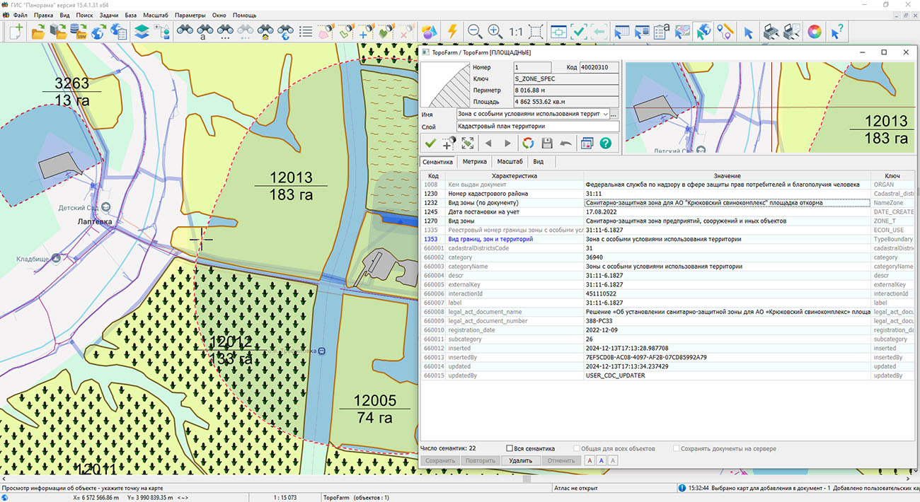
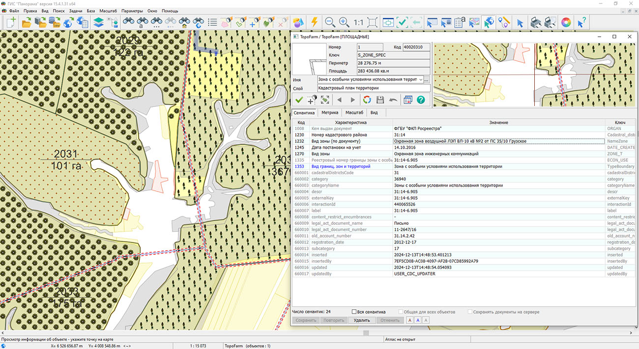
The program supports expanded access to information from the (NSDS) geoportal. Users can receive up-to-date data on the date when objects were registered, their cadastral numbers, status, land category, and the value of plots or buildings. For convenience, the layers "Land plots (labels)" and "Buildings (labels)" have been added, allowing users to quickly find necessary information directly on the map.
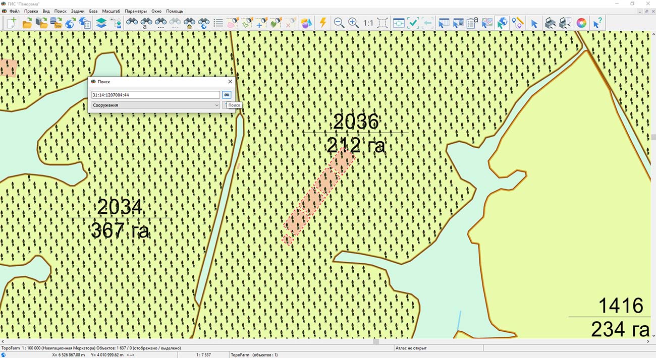
Special attention has been paid to improving search capabilities. A new search dialog has been developed that supports address search on OpenStreetMap, search by cadastral number, and cross-search in NSDS and other geoportals. Search results are displayed not only in tables but are also visualized on the map, which significantly simplifies working with large volumes of data.
For land management specialists, an expanded set of tools for processing object lists has been added, including operations for cutting and splitting complex objects from multiple cartographic sources. This is especially useful when creating detailed maps of farm infrastructure, land management, and agricultural lands.
Additionally, the algorithm for displaying labels on maps has been updated. Labels now take into account the rotation angle of the sign, ensuring more accurate and aesthetically pleasing placement of text information. For user convenience, the ability to copy point coordinates with a single click or key combination has also been added.
These changes make the "Agronomist Workstation" an even more flexible tool and help improve the quality of decisions made by specialists working in the field of land management and agronomy. The new version of the program is available in the section.
 Mobile version
 Full version
